WALLOWA VALLEY PHOTOGRAPHS
For more pages of Wallowa Valley photos, click Portfolios.
Photographically, the Wallowa Valley is a subject worthy of many portfolios. So far, there are four collections like this one, and more are on the way.
Over 4,000 feet above sea level at its upper end, the valley is abruptly flanked by the snowy Wallowa Mountains to the south and west which soar impressively well over five thousand feet above the valley floor. To the east, the craggy summits of Idaho’s Seven Devils Mountains can be seen prominently above Hells Canyon. Lacking a traffic light even in its biggest town, the valley nowhere could be described as urban even today more than a century and a half after agriculture-based civilization’s campaign to improve and manage the place. With sometimes no effort at all, you can still take photos here of a “natural” landscape.
The first surveyor who entered the valley in 1866, W. H. Odell, gushed with enthusiasm in explaining why in his opinion white men should not allow mere Indians to have this wonderful valley: “This line passes through the beautiful Wallowa Valley…Narrow streams of clear cold water put down from the high snow mountains just to the south. Timber is to the south and west and along the banks of the streams…The finest trout and salmon abound in the streams, and the surrounding mountains give evidence of plenty of game…Here I found many Indians camped on the banks of the streams, taking great quantities of fish, while their large herds of horses quietly grazed upon luxuriant grass…This valley should be surveyed as soon as practicable, for the wigwam of the savage will soon give way to the white man. Instead of the hunting and fishing grounds of the red men, the valley will teem with a thriving and a busy population.”
Or consider this description from H. R. Findley, a son of one of the earliest settler families who wrote fondly about his parents’ arrival in the Wallowa Valley: “Grand evergreen clad mountains crowned with snow capped peaks towered like mighty sentinels guarding the valley on the south and southwest…while on the east were miles and miles of bunch grass covered hills and valleys which ran on and on in undulating waves. It seemed to them that they had reached the end of their rainbow trail, the trail they had followed all the way from St. Joseph, Missouri…and here they were looking at their promised land.”
Since its “settlement” by palefaces in the 1870s, the valley’s remoteness has so far protected it from the teeming hordes envisioned by the surveyor. After a minor boom in the early 1900s, the valley’s population stabilized for nearly a century at, or not far under, 7,000 people. You can still do landscape photography here. You don’t have to drive a hundred miles or more to a national park or to some other isolated and tenuously protected and beleaguered set-aside where the vistas have not yet been totally transmogrified by the heavy hand of human ambition. But in recent years, the population in the valley has begun increasing. Will the surveyor be right in the end? Will the valley acquire its first traffic light? How ugly will things get? In these galleries can be found a vision, only somewhat phony, of what the place still looks like for discriminating photographers guided by preferences about what looks good in a landscape. You can still find scenes here that look good, landscapes with appeal.

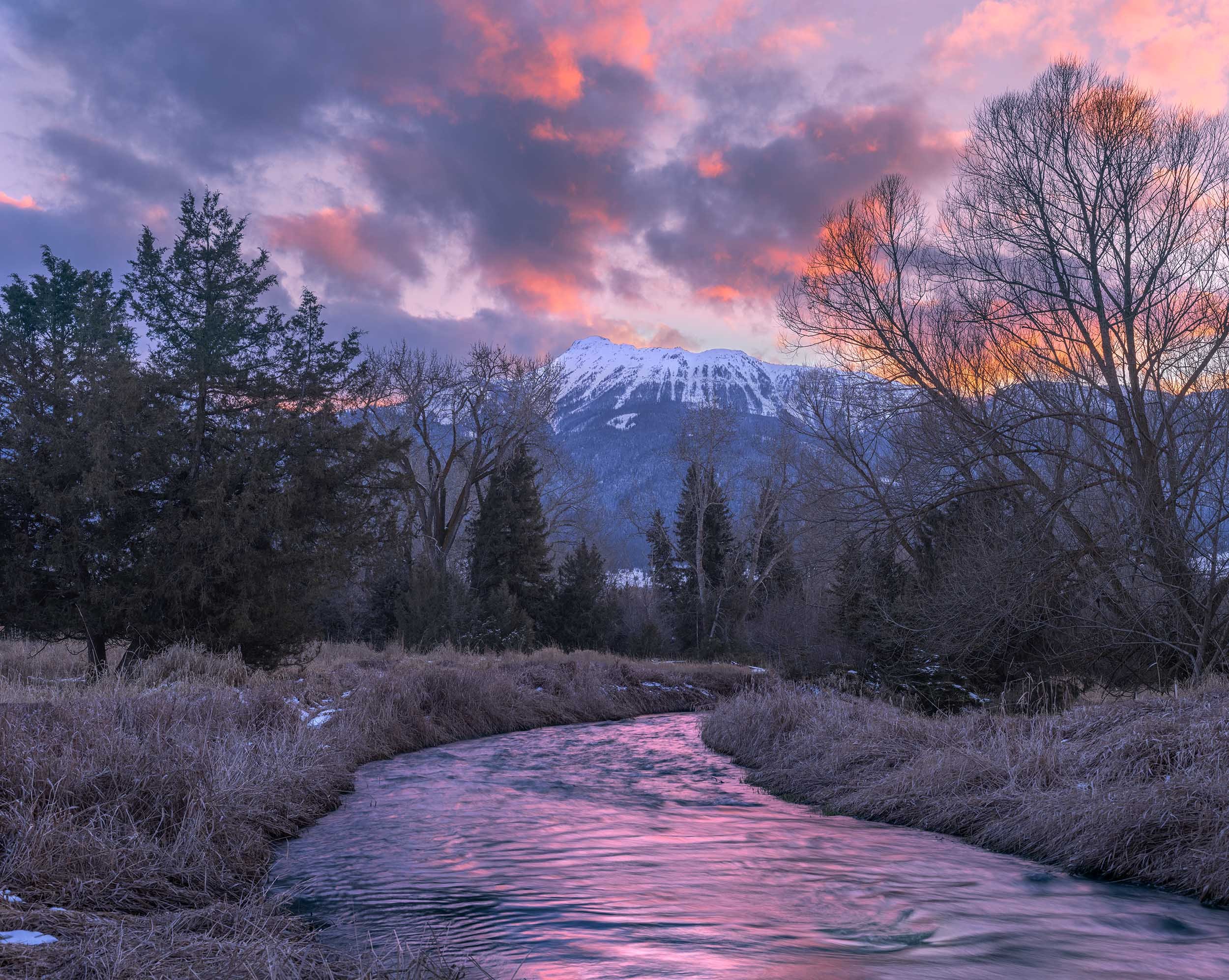
B100 Wallowa Valley cattails below Ruby Peak

B101 Twin Peaks in clouds

B102 Twin Peaks and aspens

B103 Chief Joseph Mountain

B104 Twin Peaks and cottonwoods
B105 Prairie Creek

B106 Wallowa Valley double rainbow

B107 Lightning strike, Wallowa Mountains

B108 Willow along Wallowa River

B108 Prairie Creek

B109 Trout Creek vista

B110 Trout Creek Valley

B111 Chief Joseph Mountain

B112 Prairie Creek Clearing

B113 Enterprise Wildlife Refuge

B114 Ruby Peak

B115 Prairie Creek

B116 Prairie Creek

B117 Trout Creek

B118 Prairie Creek

B119 Prairie Creek

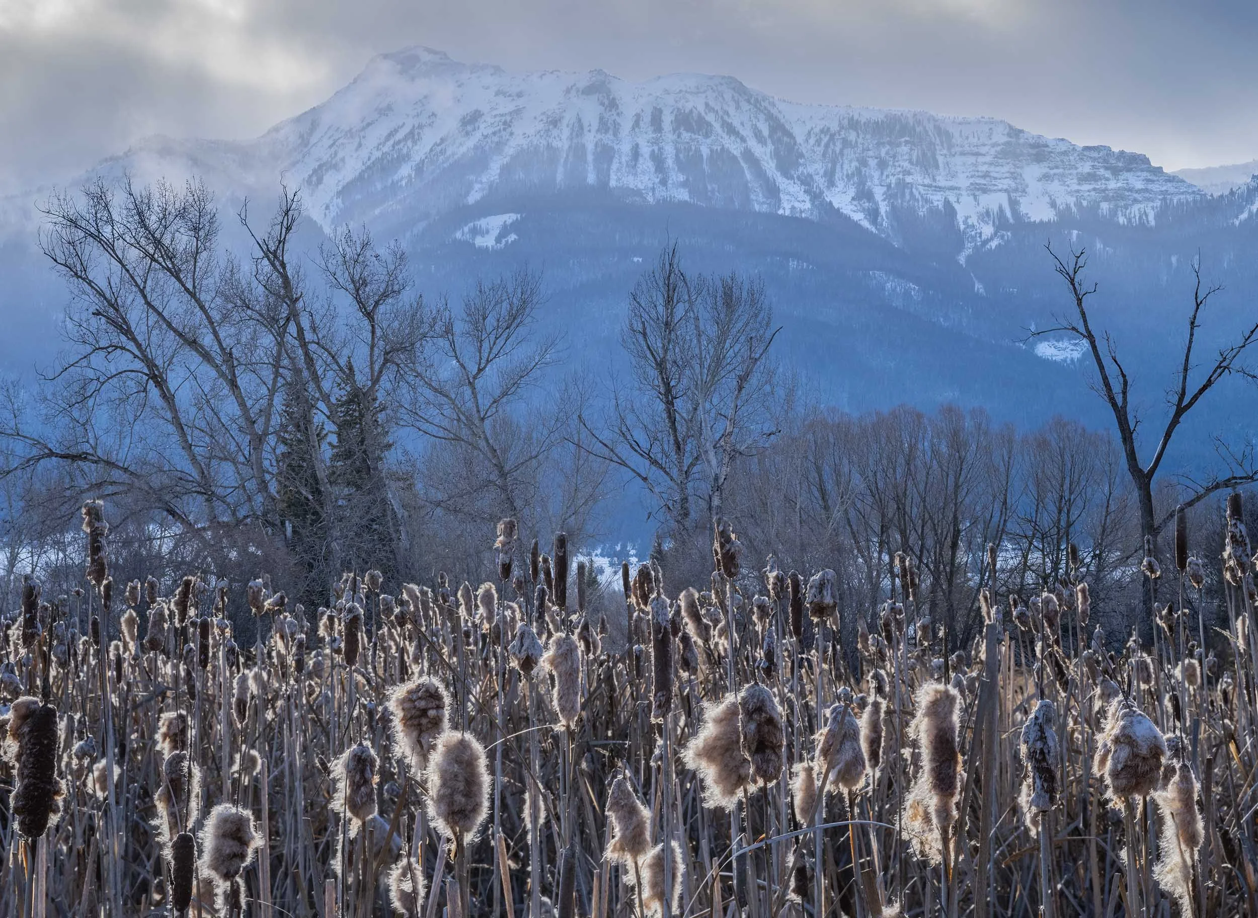
B120 Cattails below Ruby Peak

B121 Cloud layers, Wallowa Mountains

B122 Trees in fog

B123 Ruby Peak

Cattails and Ruby Peak
B125 Ruby Peak and cattails

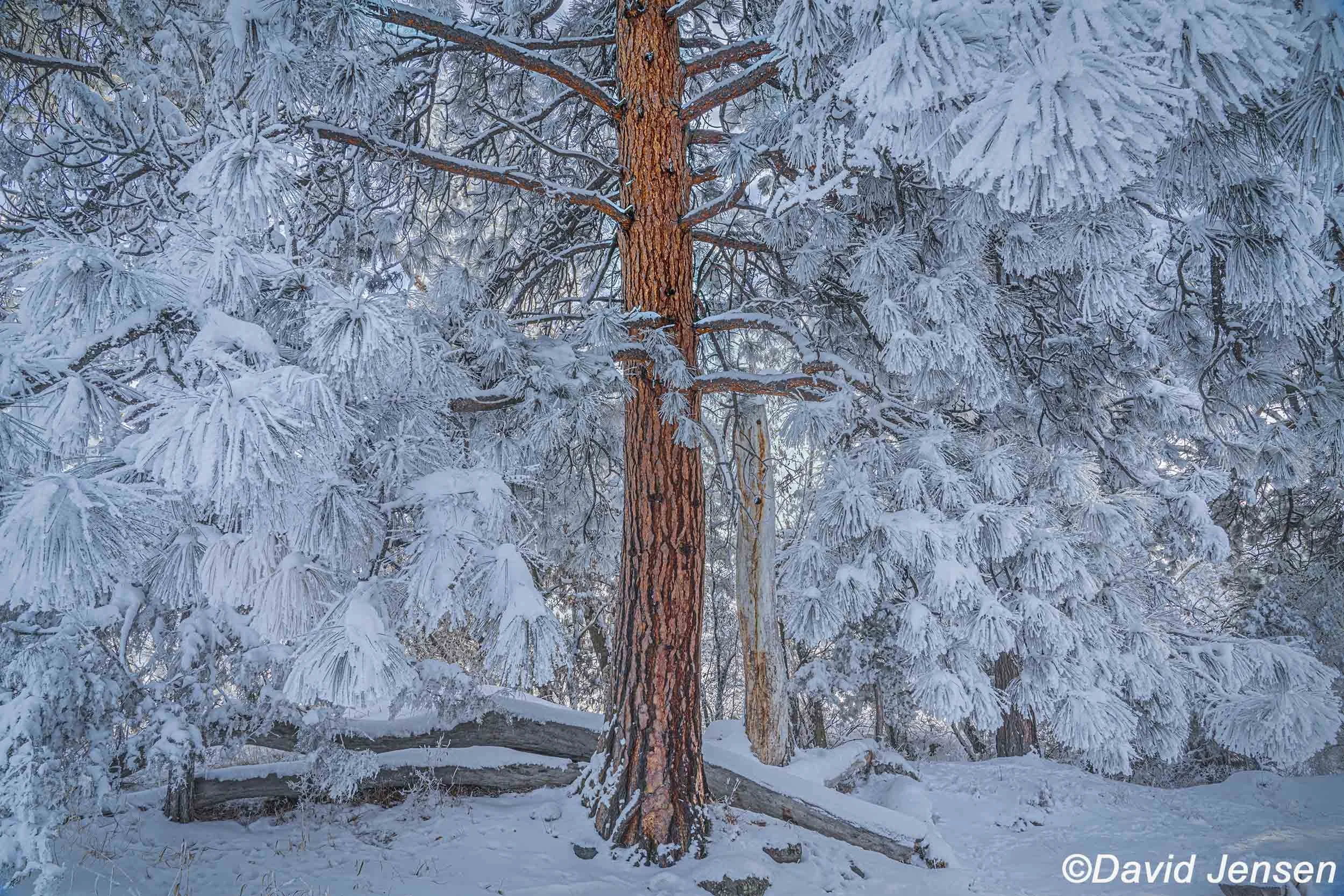
B126 Frosted ponderosa, Wallowa Valley
B127 First light on Twin Peaks

B128 Field of summer, Wallowa Valley

B129 Chief Joseph Mountains

B130 Mt. Bonneville

B131 Upper Wallowa Valley

B132 Moon over Wallowa Mountains

B133 Sawtooth Peak

B134 Wallowa Valley

B135 Wallowa Valley

B136 Enterprise Wildlife Area

B137 Wallowa Valley below Wallowa Mountains

B138 Winter in Wallowa Valley

B139 Wallowa Valley barn

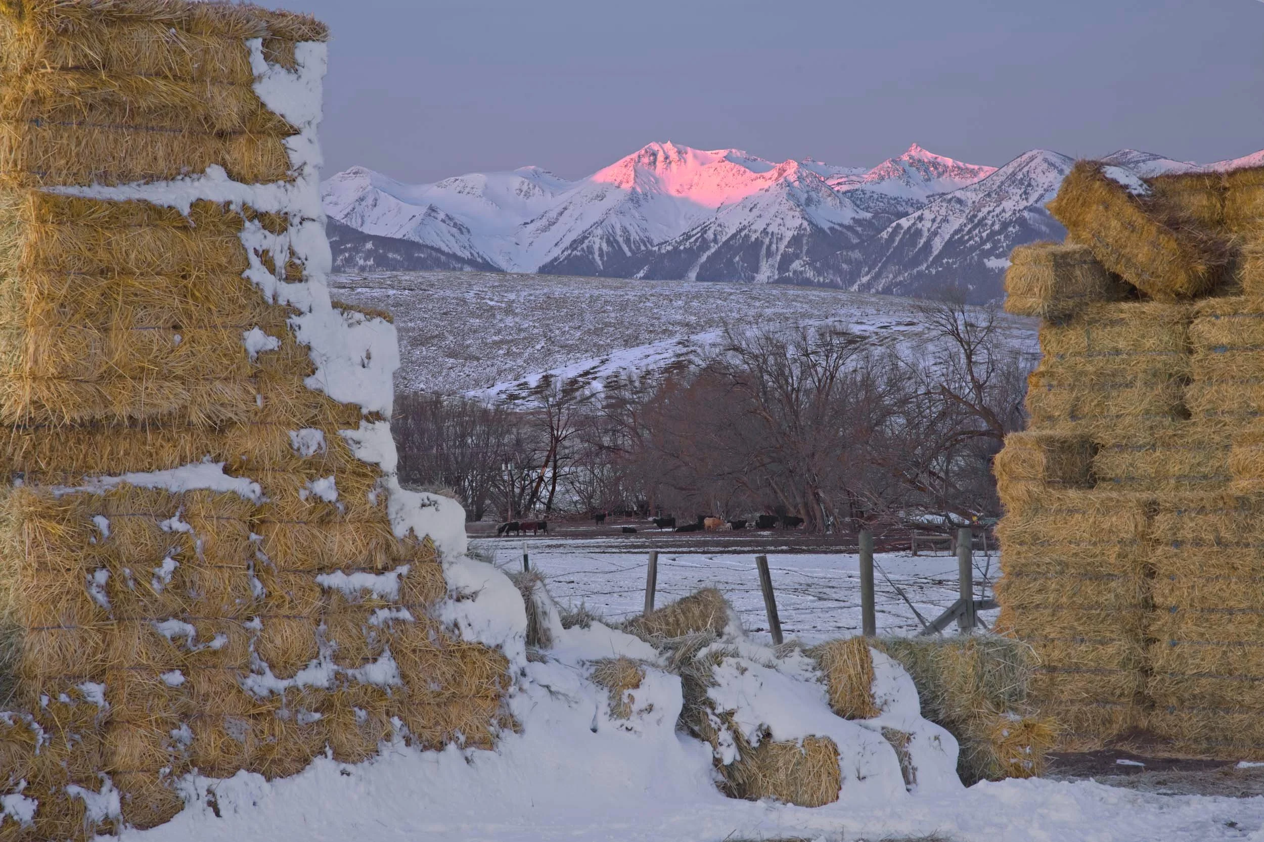
B140 Prairie Creek at sunrise

B141 Canola, Wallowa Valley

B142 Wallowa Valley barn

B143 Frost, Wallowa Valley

B144 Balsam Root blooms, Wallowa Mountains

B145 Wallowa Valley

B146 Prairie Creek, Wallowa Valley

B147 Wallowa Valley

B148 Prairie Creek, Wallowa Valley

B149 Wallowa Valley

B198 Barn, Wallowa Valley

B199 Road to Ant Flat

B200 Frosted Wallowa Valley

B150 Wallowa River

B151 Prairie Creek

B152 Cottonwoods below Twin Peaks

B153 Twin Peaks above cottonwoods

B154 Enterprise Wildlife Area

B155 Enterprise Wildlife Area

B156 Enterprise Wildlife Area

B157 Enterprise Wildlife Area

B158

B159 Wallowa Valley

B160 Wallowa Valley

B161 Chesnimnus Country and Wallowa Mountains

B162 Wallowa Lake

B163 Mountain in clouds from Wallowa Valley

B164 North Hurwal Peak

165 Trout Creek

B166 Trout Creek Valley

B167 Trout Creek

B168 Trout Creek

B169 Trout Creek

B170 Trout Creek

B171 Prairie Creek

B172 Prairie Creek

B173 Prairie Creek

B174 Praire Creek

B175 Ruby Peak

B176 Enterprise Wildlife Area and Wallowa Mountains

B177 Trout Creek

B178 Mountains in clouds

B179 Ruby Peak

B180 Wallowa Valley

B180 Lightning, double rainbow, Wallowa Valley

B190 Wallowa Valley

B191 Frosted ponderosa, Wallowa Valley
B192 Frosted ponderosa, Iwetemlaykin

B193 Frosted ponderosa

B194 Wallowa Valley

B195 Prairie Creek

B196 Prairie Creek

B197 Enterprise Wildlife Area