WALLOWA MOUNTAIN PHOTOS
Please note that this website includes many pages featuring the Wallowas—click on Portfolios for more pages (galleries) of photographs..
The photos on the Wallowa Mountains pages were taken not only within Oregon’s Eagle Cap Wilderness but in surrounding areas as well. Included are photos of the mountains from a distance—from the Wallowa, Grande Ronde, Pine Creek, and Powder River Valleys which flank this mountain range on three sides and also from the rim of Hells Canyon to the east.
The Wallowas set aside in the Eagle Cap Wilderness are favorably distinguished from other mountain ranges by lacking foothills. Yes, the Grand Tetons could not rise more abruptly from Wyoming’s Jackson Hole, and the peaks of the Sierra Nevada soar dramatically above California’s Owens Valley. But those exceptions aside, where else in the United States do mountains rise so high and so abruptly above valleys where people live and work? You don’t have to drive for miles and then hike in order to see and photograph the Wallowas. You can do that through your window at home.
Still, it’s great to get out and hike, and by hitting the trail you’ll learn things about these mountains you wouldn’t appreciate otherwise. You’ll learn, for instance, that the Wallowas, unlike Oregon’s Cascade Mountains which seem monotonously volcanic, resemble the Rocky Mountains in being made of a wide variety of much older rocks. You’ll find granitic rock like in the Sierras and Rockies, sedimentary and metamorphic rocks like in the Rockies, and, yes, volcanic rock at the very source of the great floods of lava thickly blanketing much of the Pacific Northwest.
So unlike the Cascades do the Wallowas seem that people have been moved to wonder if these mountains should be considered part of the Rockies. No geologist would support such a claim, and yet from a broad perspective all ranges of the western United States can be lumped together (including the Cascades). They all rose into the sky (at different times) because of the Atlantic Ocean’s ambition about 180 million years ago to become an ocean, sending North America on a westward drift and dramatically rumpling the continent’s western half. That narrative obscures a lot of complexity, but that’s your story if your mind craves simplicity and you like the idea of the Wallowas being part of the Rockies.
The Wallowas are also like the Rockies in being less heavily forested than the Cascades, thereby better displaying the recent, mountain-sculpting impact on the land of a great network of Ice Age glaciers . This is Oregon’s most alpine mountain range, though the glaciers at present have thrown in the towel. The remnant of ice known as the Benson Glacier was declared officially dead by the Oregon Glacier Institute in 2021, but two rock glaciers still cling to existence on mountains nearby.

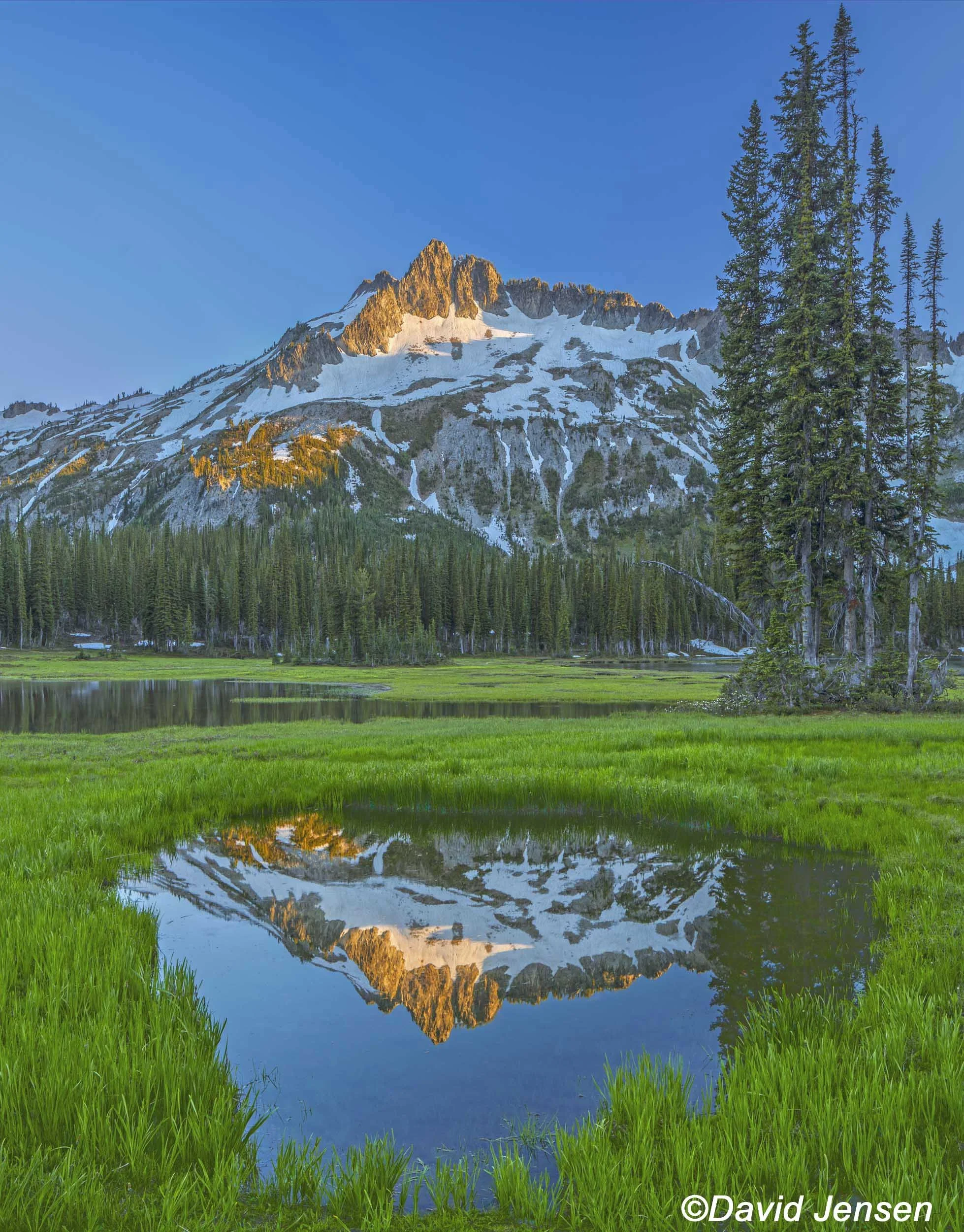
A 101 Eagle Cap Mountain and Avalanche Pond

A 102 Eagle Cap Mountain first light

A 103 Sacajawea Peak in autumn.

A104 Sacajawea Peak

A 105 North Minam Meadows

A 106 Sacajawea Peak and frosted talus.

A 107 Ruby Peak

A 108 Sacajawea Peak autumn

A 109 Aneroid Lake and Pete's Point

A 110 Aneriod Lake autumn

A 111 Wallowa Lake and Wallowa Mountains

A 112 Avalanche pond and Eagle Cap Mountain

A 113 Eagle Cap Mountain

A 114 Ponderosa Pines Wallowa Mountains
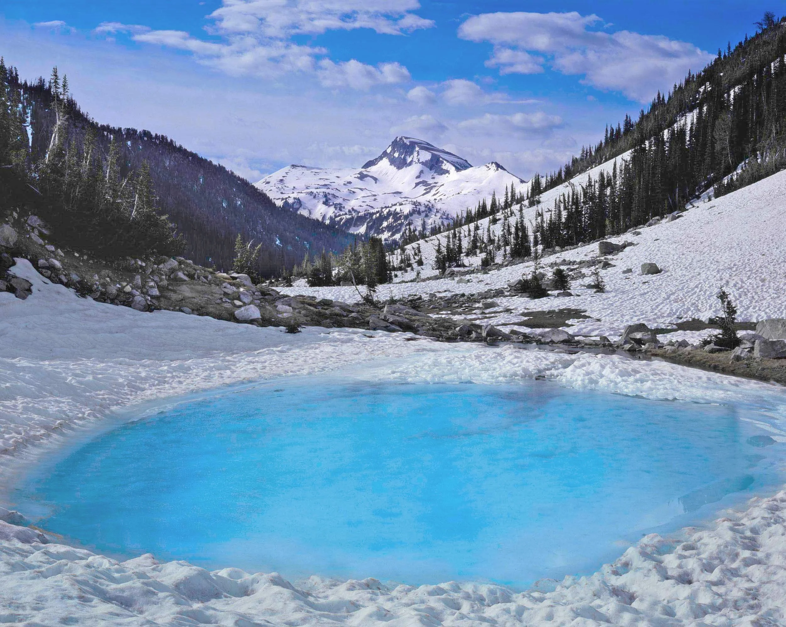
A 115 Eagle Cap Mountain and avalanche pond.

A 116 Eagle Cap Mountain and penstemon

A 117 Glacier Lake and heather

A 118 Hidden Lake and bog laurel
A 119 Hurricane Creek

A 120 Ice Lake

A 121

A 122 Lostine River, moon, Eagle Cap Mountain

A 123 Wallowa Mountains in winter

A 124 Wallowa Mountains July sunset

A 125 Red Mountain and heather

A 126 Sacajwea Peak, Hurricane Creek

A 127 Sacajawea Peak, Hurricane Creek

A 128 Hurricane Creek, Sacajawea Peak

A 129 Matterhorn and larch

A 130 Flagstaff Point

A 131 North Hurwal Peak

A 132 North Hurwal Peak

A 133 Marble Mountain

A 134 Wallowa Mountains under milky way

A 135 Cusick Mountain

A 136 Wallowa Mountains last light

A 138 Castle Rock and East Eagle Creek

A 139 Crater Lake and Granite Mountain

A 140 Eagle Cap Mountain and alpine fleece flower in autumn

A 141 Eagle Cap Mountain autum

A 142 Cornices on North Hurwal Peak

A 143 Hoar frost on snow Hurricane Creek Canyon

A 145 Twin Peaks moonset

A 146 Matterhorn afterglow

A 147 Sawtooth Peak

A 148 Avalanches at sunrise

A 149 Farm below Chief Joseph Mountain

A 150 Matterhorn sunset

A 151 Wallowa Valley and Mt. Bonneville

A 152 Early Winter on the Matterhorn

A 153 Moon over the Wallowa Mountains

A 154 Ponderosa Grove

A 155 Craig Mountain and whitebark pine

A 156 Cusick Mountain from Wallowa Valley

A 157 Lakes Basin under Milky Way

A 158 Sawtooth Peak

A 159 Matterhorn and larch

A 160 Sunrise Eagle Cap Mountain

A 161 Matterhorn from Hurricane Creek

A 162 Matterhorn and Hurrucane Creek at sunset

A 163 Wallowa Mountains from Matterhorn summit

A 164 Wallowa Mountains from Matterhorn summit

A 165 Matterhorn

A 166 Matterhorn and paintbrush

A 167 Matterhorn at sunset

A 168 Winter sunset Matterhorn

A 169 Eagle Cap Sunshine Lake

A 170 Jackson Peak
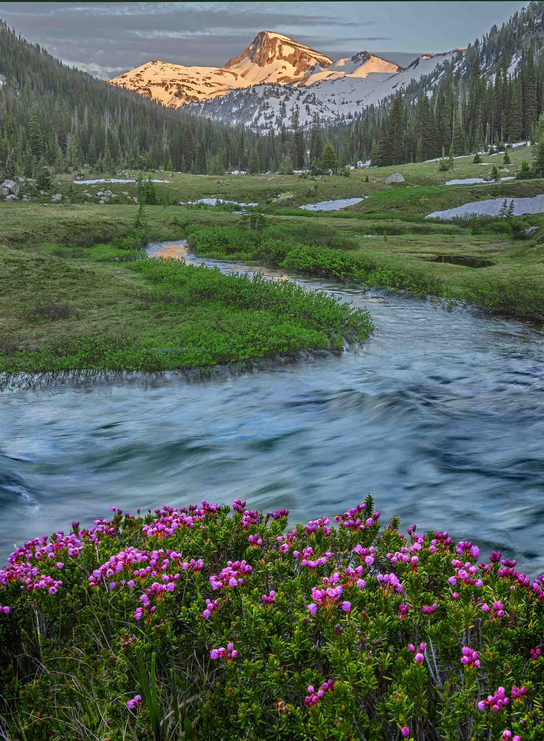
A 171 Eagle Cap and Lostine River

A 172 Eagle Cap and Lostine River

A 173 Eagle Cap Mountain and heather
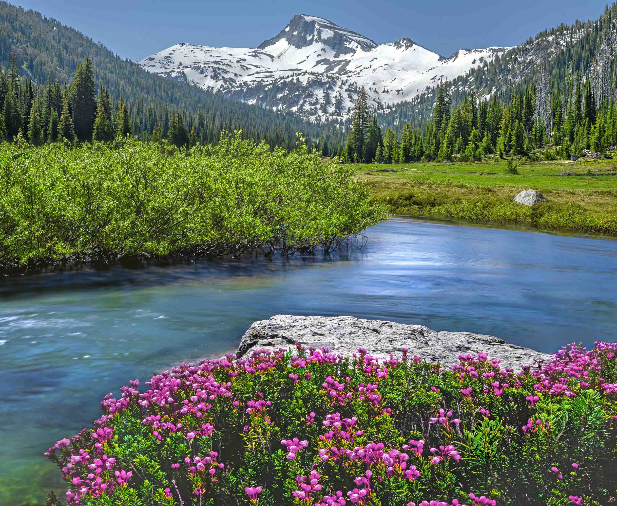
A 173 Eagle Cap Mountains and Lostine River

A 174

A 175 Eagle Cap Mountain North Face

A 176 Glacier Peak from Glacier Lake

A 177

A178 Downed Whitebark Pine at Glacier Lake

A179

A180 Heather at Glacier Lake

A181 Glacier Lake sunrise

A182

A183 Thawing Glacier Lake

A184 Glacier Lake under Milky Way

A185 Glacier Lake sunrise

A186 Glacier Peak

A187 Glacier Lake

A188

A189 Sacajawea Peak and Hurricane Creek

A190 Jackson Peak and source of Imnaha River

A191 Jackson Peak autumn

A192

A193 Jackson Peak and lupine

A194

A195 Matterhorn West Face

A196 Matterhorn and tamaracks autumn

A197 Matterhorn West Face

A198 Matterhorn moonlit

A199 Moonlit Matterhorn in Clouds

A200 Climbing the Matterhorn

A201 Sacajawea Peak in the Wallowas

A202 Sacajawea Peak from Hurrucane Creek

A203 Sacajawea Peak ans Hurricane Creek

A204 Sacajawea Peak

A205 Sacajawea Peak in winter

A206 Glacier Lake

A207 Glacier Lake and Glacier Peak

A208 Glacier Lake

A209 Heather and Jackson Peak

A210 Hurricane Creek and Sacajawea Peak

A211 Sacajawea Peak

A212 Wallowa Mountains from moraine of Wallowa Lake

A213 Jackson Peak and heather

A214 Moonset at dawn Wallowa Mountains

A215 Matterhorn in clouds

A216 Matterhorn and larches

A217 Matterhorn in clouds

A218 Matterhorn west face

A219 West Face Matterhorn in Eagle Cap Wilderness

A220 Dollar Mountain

A221 Larches in pine forest

A222 Tamaracks above Imnaha River

A223 Frosted Ponderosa

A224 Red Mountain and lupine

A225 Red Mountain and lupine

A226 Heather at Glacier Lake

A227 Bog laurel at Hidden Lake

A228 Bog laurel at Hidden Lake

A229 Hidden Lake

A230 Heather below Eagle Cap Mountain

A231 Heather below Eagle Cap Mountain

A232 Lupines overlooking Blue Lake

A233 Ponderosas in winter

A234 Ponderosas in winter

A235 Ponderosas

A236 Sacajawea Peak autumn

A237 Sacajawea Peak glazed in ice

A238 Sacajawea Peak autumn

A239

A240 Sacajawea Peak

A241 Sacajawea Peak from avalanche burn

A241 Aspens and Sacajawea Peak

A242 Sacajawea and frosted talus

A243 Sacajawea Peak

A245 Sacajawea Peak autumn

A236 Aspens below Sacajawea Peak
A247 Pond at Hidden Lake

A248 Hidden Lake

A249 Miner's cabin in Eagle Cap Wilderness

A250 Ruby Peak from Prairie Creek